

 Facebook
 X
X
 Pinterest
 Copy Link


When Houstonians talk about the city’s defining features, the bayous always come up. Among them, Brays Bayou, often associated with the Braeswood neighborhoods and Texas Medical Center, stands out as a waterway that has shaped the city’s growth, culture, and resilience for nearly two centuries.
Early Origins and Naming
Brays Bayou stretches about 31 miles through Harris County, flowing east from near Barker Reservoir and George Bush Park to its confluence with Buffalo Bayou at Harrisburg. Its name has sparked debate for decades. Some historians believe it comes from James Bray, an early settler who arrived in the area around 1822. Others suggest the term “Braes” derives from the Scottish word brae, meaning hillside or slope (a nod to the gentle banks along the bayou). By the late 1820s, diaries from settlers like Joseph Clopper referenced “Bray’s Bayou,” cementing its place in Houston’s early maps and lore.
A Bayou at the Heart of Houston
As Houston grew, Brays Bayou became a central geographic feature. It winds through neighborhoods such as Meyerland, Braeswood Place, and Riverside Terrace, and skirts landmarks like Rice University and the Texas Medical Center. Its watershed covers 129 square miles and supports over 700,000 residents today. This urbanization, however, came with challenges… ie. flooding.
Flooding and Resilience
Brays Bayou has a long history of catastrophic floods. Records show major events as early as 1843, when heavy rains submerged bridges leading into Houston. Subsequent decades brought repeated disasters: in 1943, flooding inundated Bellaire and southeast Houston, damaging over 11,000 homes; in 2001, Tropical Storm Allison dumped more than 20 inches of rain, causing $5 billion in damages and devastating the Texas Medical Center.
In late August 2017, Hurricane Harvey unleashed unprecedented rainfall across Houston, marking the most significant flooding event in the city’s history. Over five days, Harvey dumped more than 29 inches of rain near the Texas Medical Center, and Brays Bayou surged to a record gage height of 45 feet—28 feet above its normal level. This catastrophic rise overwhelmed floodplains and inundated thousands of homes along the bayou.
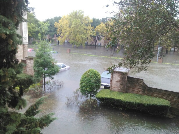 Neighborhoods in the Brays Bayou watershed were among the hardest hit. Meyerland saw flooding in 83% of homes, while Braeswood Place and Bellaire experienced widespread devastation, forcing residents to evacuate and rebuild. Streets turned into rivers, and residents navigated their neighborhoods by canoe and kayak. For many, Harvey shattered assumptions about flood risk: areas previously considered safe were submerged, proving that the storm exceeded even the 500-year floodplain projections.
Harvey’s impact underscored the vulnerability of Houston’s bayou system. Despite decades of flood-control projects, the sheer volume of water overwhelmed infrastructure. The disaster caused $125 billion in damages nationwide, with Brays Bayou neighborhoods bearing a significant share of the loss. 
These events spurred massive flood-control initiatives. The U.S. Army Corps of Engineers began studies in the 1980s, leading to Project Brays, a multi-decade effort involving channel widening, detention basins, and green infrastructure. Today, Arthur Storey Park and other detention areas stand as symbols of Houston’s commitment to mitigating flood risk.
Modern Transformation: From Floodplain to Greenway
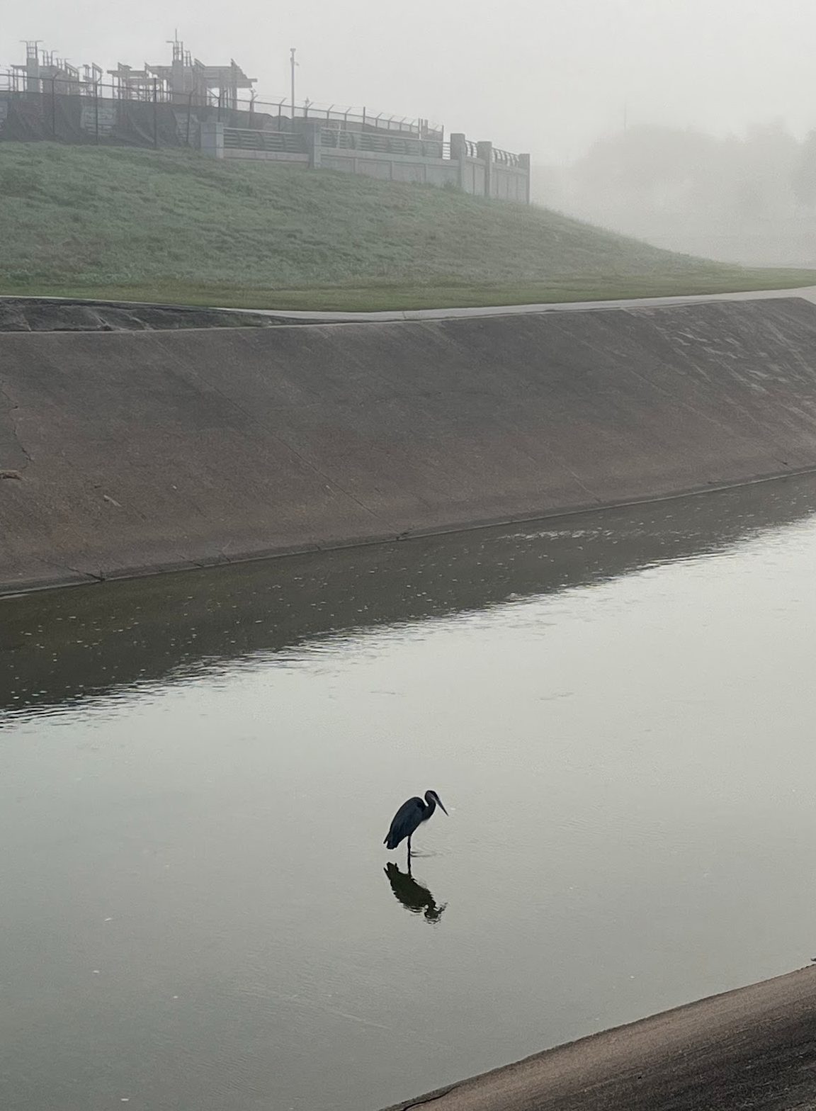
Beyond flood control, Brays Bayou has evolved into a recreational and ecological asset. The Brays Bayou Greenway Project, launched in the 2010s, added miles of hike-and-bike trails, pedestrian bridges, and parkland. These improvements connect communities from Mason Park to the University of Houston, turning the bayou into a scenic corridor for outdoor activity and urban wildlife.
The Brays Bayou Greenway Project is entering an exciting new phase aimed at improving connectivity, accessibility, and community engagement. Over the next three years, the Houston Parks Board, in partnership with Harris County Precinct 4, will invest $6.6 million in enhancements along the greenway. These plans include:
- 4.4 miles of new or upgraded trails, including a 10-foot-wide concrete path replacing older asphalt segments between Fondren and Braeburn Glen.
- Seven new pedestrian and bicycle underpasses at key intersections such as Chimney Rock, Hillcroft, Fondren, and Braeswood Boulevard, improving safety and reducing street-level crossings.
- A one-mile trail segment on the north side of Brays Bayou between Chimney Rock and Hillcroft, connecting to the Atwell Pedestrian Bridge.
- An ADA-accessible trail connection to a METRO bus stop at Mullins Drive, ensuring inclusivity for all users.
- The creation of the Captain Gary L. Herod Memorial Plaza near Mullins Drive, honoring the Texas National Guard pilot who heroically sacrificed his life in 1961 to prevent a catastrophic crash. The plaza will feature landscaping, lighting, benches, and commemorative signage.
These improvements will contribute to a fully connected 34-mile Brays Bayou Greenway, stretching from Archbishop Fiorenza Park in west Houston to the Houston Ship Channel in the east. Beyond recreation, the project reflects a broader vision: creating equitable access to green space, promoting wellness, and enhancing flood resilience through sustainable design.
Why Braeswood Matters
For residents of Braeswood Place and surrounding neighborhoods, the bayou is more than a waterway, it’s a living piece of Houston’s history. It tells a story of settlement, struggle, and adaptation. From its mysterious name to its modern greenway, Brays Bayou reflects the resilience and ingenuity that define the Bayou City.
And don’t forget the Knollwood Running Club!
